Licensing status
In correspondence dated October 28, 2026, Ontario's Ministry of Natural Resources stated that no aggregate licence or aggregate licence application was on file for this property.
Written Ministry correspondenceA community-led effort to protect the Head Lake and Laxton landscape. Residents can review verified information, raise concerns about potential quarry impacts, and contribute observations without publicly identifying themselves.
Independent resident initiative. Not affiliated with the City of Kawartha Lakes or the Province of Ontario. No organizers or contributors are publicly identified.

We distinguish published government records and written official responses from observations, questions and unverified connections.
In correspondence dated October 28, 2026, Ontario's Ministry of Natural Resources stated that no aggregate licence or aggregate licence application was on file for this property.
Written Ministry correspondenceIn an October 28, 2026 email, a City planner identified the property as Agricultural (AG) and stated that a quarry is not a permitted use. The City and Ministry were investigating at that time.
Written City correspondenceOntario's Environmental Registry lists a 32-hectare, below-water-table quarry proposal at Part Lot 10, Concession 4, Laxton, under ERO 012-7796. The posted status is Proposal Updated, not an approval.
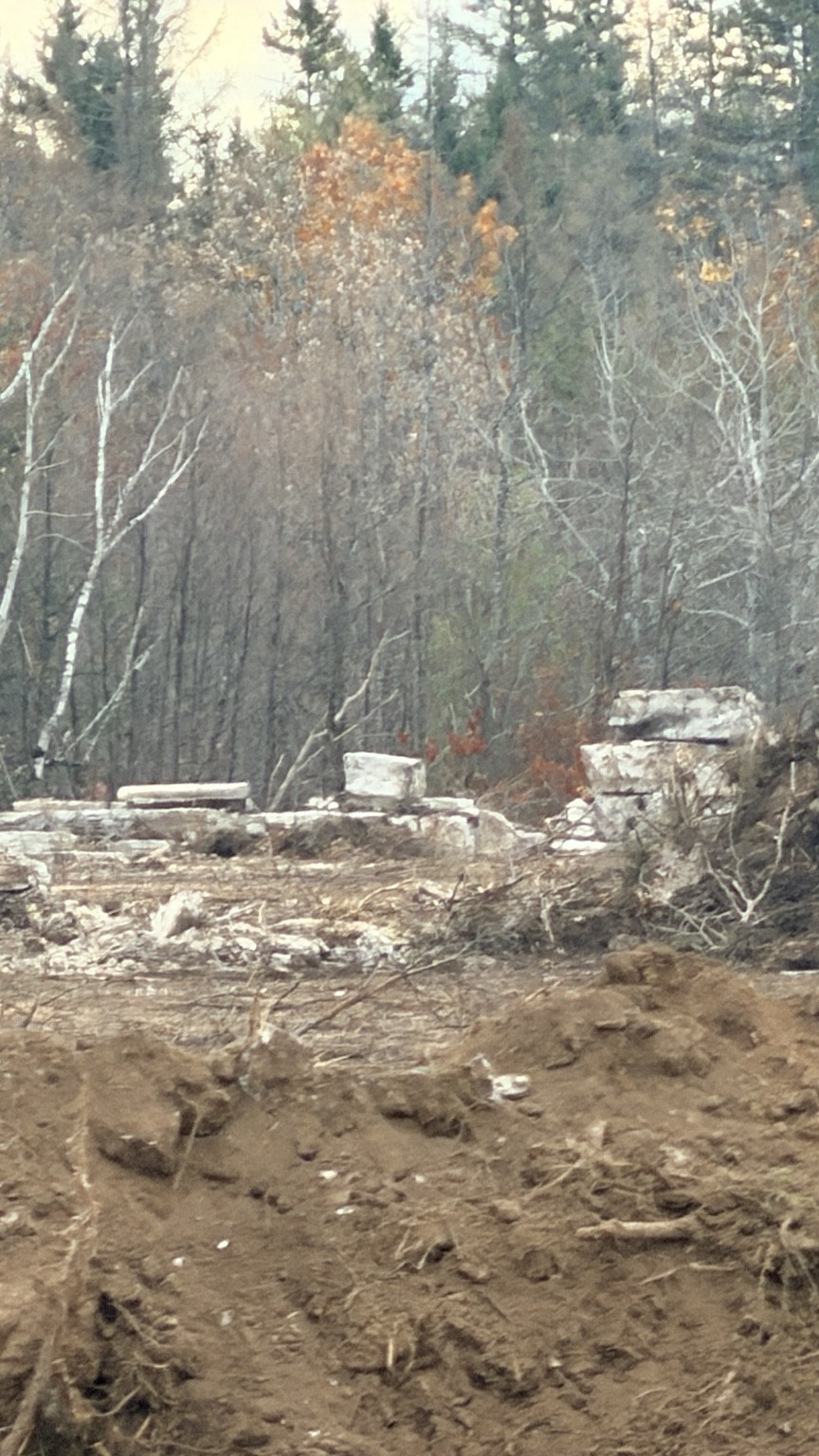
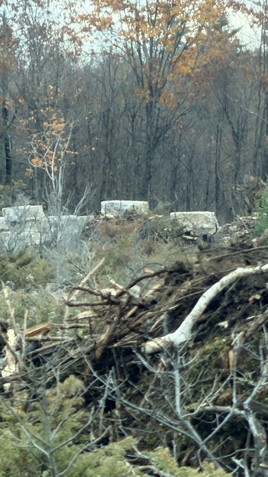
Read the official notice ↗Residents have reported excavators, ground disturbance, rectangular stone blocks and heavy vehicle movement near 592 Digby–Laxton Boundary Road. Photographs may document conditions, but do not independently prove where the stone originated or whether work is unauthorized.
Concerns have been raised about a newly constructed access near a hill crest, vehicle sightlines and heavy truck traffic.
Questions include possible effects on groundwater, nearby natural heritage features, tree cover, dust and noise. A parcel-level ecological assessment is needed before claiming protected habitat was harmed.
Residents want clarity about proposed extraction boundaries, haul routes, rehabilitation obligations, studies, public consultation and any future approvals.
Your well, your home and the enjoyment of your property matter. Potential effects depend on the actual operation, distance, local geology, truck routes and mitigation. The points below are questions to investigate, not findings that damage has occurred.
Ask whether excavation or water pumping could affect groundwater levels, well supply or water quality. Request the relevant water studies, monitoring arrangements and response plan for reported well problems. A nearby activity alone does not establish the cause of a water change.
Ask about operating hours, processing equipment, dust controls and proposed buffers. Keep a dated record of conditions affecting outdoor space, windows or everyday activities, and distinguish what you observed from what you suspect.
If blasting is proposed, ask for the blast-design assessment, monitoring arrangements and whether a pre-blast condition survey is offered. Photograph existing cracks and conditions privately. A new crack or felt vibration does not by itself prove structural damage or its cause; obtain qualified advice if concerned.
Request proposed haul routes, truck volumes and entrance-sightline information. Note effects on driveway access, walking and cycling from a safe, lawful place. Do not assume your road is an approved haul route simply because you have seen a truck.
We do not have a property-specific appraisal establishing a loss in value. We cannot say that your home will lose value or assign a percentage. For an individual assessment, seek an independent qualified appraiser using local evidence and the actual project details.
Keep dated photographs, well records, laboratory results and maintenance records securely. Ask a qualified well professional about baseline water level and supply checks. Public Health Ontario's routine well testing checks bacterial contamination; it does not establish water quantity or rule out every chemical concern.
Start with the site's plans and technical studies. Ask for the water, noise and blasting information relevant to the actual proposal, plus haul-route and traffic information where available.
Use the Community Action Centre to prepare a factual request or report →
ERO 012-7796 posted for public comment. This is a different legal parcel from 592.
The Ministry reported that the Squire proposal was still under consideration.
A nearby resident documented equipment, disturbed ground, stone blocks and truck activity around 592.
Municipal enforcement confirmed a site visit and an open investigation. This is not an enforcement finding.
Ministry and City staff confirmed the licensing and zoning findings described above and indicated that concerns were being investigated.
The Ministry acknowledged additional photographs and continued reviewing concerns. A separate records response confirmed the Squire application reference 624850 and ERO 012-7796.
Last editorial review: November 2, 2026. This is not a live government status feed.
Residents have documented stone blocks, heavy equipment and disturbed ground. Photographs and documents will be published only after review for accuracy, location sensitivity, permission, and identifying details. Only metadata-cleaned review copies are shown below. Original files remain private.


Browse the public records index for dated official-response summaries, source links and the documents still being requested. Not every record gathered is suitable for public release.
Read the dated agency-response summaries. Original email chains remain private to protect residents’ identities.
If you have first-hand observations, photographs, public records, meeting notices or corrections, we want to make it safe to contribute once our private submission channel is ready.
Resident submissions will never be automatically published. Please do not include speculation about individuals, private addresses unrelated to the project, licence plates, personal contact details of others, or material obtained unlawfully. For urgent safety concerns, contact the appropriate authority directly.
Please provide dates and locations as accurately as possible and distinguish what you personally witnessed from what someone told you.
We are preparing a submission channel that allows residents to contribute without publishing their names. No personal account will be required solely to share an observation.
What you will be able to share: dated observations, general locations, photos, public documents, road concerns and corrections. You will be able to omit contact information.
Important privacy limitation: submitting data online is not guaranteed to be anonymous to the service provider. Hosts may log IP addresses and device information. Photos and documents may contain GPS, author, device, or other identifying metadata.
We will not publish original uploads, personally identifying details or allegations about individuals without review. We will not publish contributor names by default.
Not yet accepting submissions. The secure collection service, retention policy, access controls, and privacy notice must be configured and tested before this feature is enabled.
View the closed submission channel · Privacy and contributor protection · Safety rules
Head Lake and Laxton is our first focus. Separate community pages can be added after review of local sources, permissions and privacy. The Community Action Centre offers Ontario-wide tools now.